An Introduction to David Gee; GERC PhD student in Remote Sensing and GIS
First of all let me introduce myself, my name is David Gee and I am a first year PhD student at the GeoEnergy Research Centre (GERC). Originally from Solihull, I have spent all of my higher education at the University of Nottingham, a place I now call home. I first arrived here to complete a degree in Geography during which I developed an interest in remote sensing and GIS. It was shortly after undertaking an optical remote sensing dissertation in my final year that I realised I was keen to undertake research. Having completed a photogrammetry project at the Nottingham Geospatial Institute (NGI) earlier in the year, I was intrigued to find out what other research the institution conducted.
At the NGI, for my MSc the following academic year, I conducted a year of research using radar interferometry and geodetic levelling to investigate and validate ground motion over a gas production and geostorage site in the Netherlands. After an interesting and engaging year, an opportunity arose to work commercially for a university start up, Geomatic Ventures Limited, who conduct ground motion surveys using radar interferometry. The United Kingdom was naturally the focus of the many of the surveys we conducted, so I knew first-hand what a complex environment in terms of ground motion it has been and continues to be. Many areas that were particularly dynamic were over areas of former mining, so I was particularly keen to take up the opportunity to investigate the cause of this motion for GERC. I returned to the University of Nottingham in October 2016 with the support of a number of partners including Geomatic Ventures Limited, the British Geological Survey and the Coal Authority.
A number of studies have demonstrated that changing groundwater levels is a key parameter that determines land motion above active and abandoned coalfields. However, only a limited number of studies have been undertaken to fully understand this relationship. Previous investigations have suggested a correlation between mine water levels and land surface motion, yet in some cases the surface is not particularly affected by groundwater levels. The aim of my research is to investigate ground motion over former coalfields in the UK, conducting surveys using both archive satellite data and current imagery from the latest Sentinel-1 satellite. Using relevant mining, geological and hydrogeological data we are able to better understanding the post mining environment and are working towards developing a quantitative tool to predict mine and groundwater levels.
This has important consequences for the management of such areas and could provide new insights for the Coal Authority in their management mining legacy issues. Additionally, it has implications for the future extraction of natural resources in these locations where techniques, such as hydraulic fracturing, where water is injected into rocks under high pressure, could have additional effects.
I am currently 6 months into my PhD, and have had a very positive experience of GERC so far. We are close to submitting a paper on a study over the Northumberland and Durham Coalfield, the results of which I have recently presented at a national conference.
At the NGI, for my MSc the following academic year, I conducted a year of research using radar interferometry and geodetic levelling to investigate and validate ground motion over a gas production and geostorage site in the Netherlands. After an interesting and engaging year, an opportunity arose to work commercially for a university start up, Geomatic Ventures Limited, who conduct ground motion surveys using radar interferometry. The United Kingdom was naturally the focus of the many of the surveys we conducted, so I knew first-hand what a complex environment in terms of ground motion it has been and continues to be. Many areas that were particularly dynamic were over areas of former mining, so I was particularly keen to take up the opportunity to investigate the cause of this motion for GERC. I returned to the University of Nottingham in October 2016 with the support of a number of partners including Geomatic Ventures Limited, the British Geological Survey and the Coal Authority.
 |
| The Nottingham Geospatial Institute |
A number of studies have demonstrated that changing groundwater levels is a key parameter that determines land motion above active and abandoned coalfields. However, only a limited number of studies have been undertaken to fully understand this relationship. Previous investigations have suggested a correlation between mine water levels and land surface motion, yet in some cases the surface is not particularly affected by groundwater levels. The aim of my research is to investigate ground motion over former coalfields in the UK, conducting surveys using both archive satellite data and current imagery from the latest Sentinel-1 satellite. Using relevant mining, geological and hydrogeological data we are able to better understanding the post mining environment and are working towards developing a quantitative tool to predict mine and groundwater levels.
 |
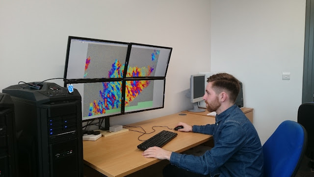
| Inspecting interferograms at Geomatic Ventures |
This has important consequences for the management of such areas and could provide new insights for the Coal Authority in their management mining legacy issues. Additionally, it has implications for the future extraction of natural resources in these locations where techniques, such as hydraulic fracturing, where water is injected into rocks under high pressure, could have additional effects.
I am currently 6 months into my PhD, and have had a very positive experience of GERC so far. We are close to submitting a paper on a study over the Northumberland and Durham Coalfield, the results of which I have recently presented at a national conference.
*You can keep up to date with GERC activities on our social media channels*
Comments
Post a Comment