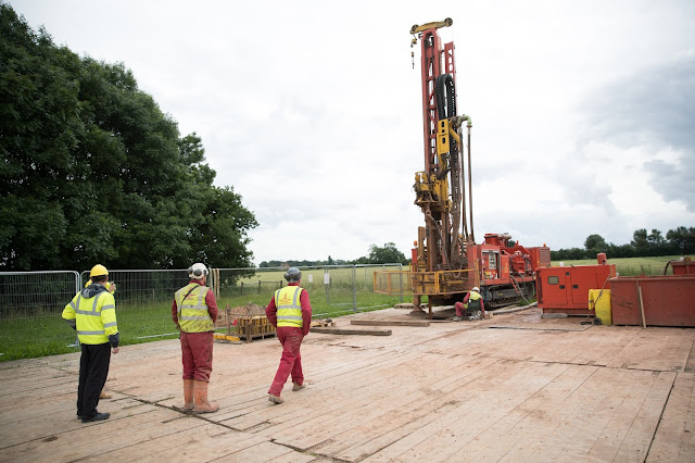
Creating the GeoEnergy Test Bed: You wait for one borehole and then five come along at once!
By Lindsay Holowka; GERC Centre Administrator
Drilling,
logging, surveying…….yup, it’s been a busy 2016 for the GeoEnergy Test Bed
(GTB).
A £2.5
million financial boost provided by The Energy Research Accelerator (ERA) means the GTB (now a
G-ERA facility) has seen a substantial amount of construction work this
year…….and we’re still going!
What is the GeoEnergy
Test Bed?
The GeoEnergy Test Bed (GTB) is
a field laboratory, managed on behalf of G-ERA by the GeoEnergy Research Centre
(GERC), to carry out geological measurements plus research and monitor the
processes around fluid migration through natural pathways in the subsurface
rock layers. The data from these measurements will be crucial to support the
development of new and more accurate computer simulations of underground fluid
flow as well as to develop sensor technologies.
A detailed 3D geological model of the GTB will be generated through
detailed characterisation of the site geology and laboratory testing of rock
samples. Following geological characterisation of the site, experiments will be
carried out at this safe facility that will aid the development of affordable
low-carbon energy and technologies for effective management of the subsurface.
So how do we
characterise the GTB?
Drilling, logging, surveying….you get the idea.
It formally started in July 2015 with
the drilling of the first borehole (169m) by the Corps of Royal Engineers. This was followed by an Electrical Resistivity
Tomography survey and a soil-gas survey of the site in the autumn.
In 2016, once we’d let the
weather warm up a bit (no-one likes working in the cold), we really got going
with characterising the GTB. A second soil-gas survey was conducted before
drilling commenced in June on the second (90m) and third (270m) boreholes. Rock
cuttings were taken every metre from the drilling of the third borehole to aid
with characterisation. This was swiftly followed by the geophysical logging of
the first and third borehole by Robertson Geologging Ltd.
 |
| Drilling the third borehole in June 2016 |
 |
| Robertson Geologging Ltd logging the third borehole |
Surveys of varying kinds were undertaken at the GTB during
autumn including passive seismic, shallow refraction, microbiology and cone
penetration surveys. Plus downhole imaging of the first borehole and a
pumping/recovery test of the third borehole before the next round of drilling
commenced in November.
Throughout November and continuing into December a total of
five borehole will be drilled. The fourth borehole has been completed to a
depth of 282m and is fully cored. This full depth core gives our researcher’s
physical samples they can analyse of the strata at the GTB. The fifth and sixth
boreholes should reach a depth of 290m whilst the seventh and eighth boreholes
will be much shallower at 25m.
You can see more photographs for the work undertaken on the GTB by visiting the 2015 and 2016 galleries on our GERC website .
 |
| A three meter length of core extracted from the fourth borehole in November 2016. This will be cut in two for storage. |
What research are we
planning on doing at the GTB?
The research involved will range from refining techniques
for monitoring fluid migration through natural pathways in the subsurface, to
the development of software for accurately modelling geological reservoirs.
Early streams of research will be laboratory based to determine the physical
and chemical properties of rock core samples to help better understand the sites
geological composition.
The GTB provides a unique facility to deploy and improve next-generation sensor technologies such as optical,
acoustic and gravity sensors alongside advanced satellite and GPS controlled
airborne platform earth observation technologies. The boreholes will be fully
instrumented with surface and down-hole sensors. Boreholes will be monitored
permanently with the sensors sending data, automatically and continuously, to
an onsite control centre.
Scientific experiments will be conducted to understand the
in-situ mechanisms rates and interactions of fluid migration in the subsurface.
A significant resource will be created in the form of large datasets relating
specifically to reservoir fluid flow, fluid chemistry and geophysical data. These
datasets will aid with the development of modelling software and to validate current software simulations to support more
accurate reservoir scale models of permeability and fluid migration. Data
collected from the GTB will be used for the development and validation of
advanced fluid flow and reservoir simulation software in partnership with Schlumberger.
*You can keep up to date with GERC activities on our social media channels*
Comments
Post a Comment